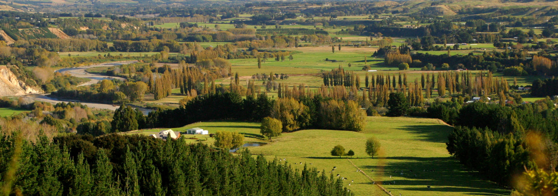
The Manawatu-Whanganui Region covers an extensive, varied and largely rural portion of the mid to lower North Island. The region stretches from Taumarunui in the north to just south of Levin in the south, a distance of 285 km, and from a short stretch of the east coast to almost 200 km of the lower North Island’s west coast. The region’s north is dominated by the Central Plateau and features several active volcanoes that rate as the North Island’s highest points within one of the world’s earliest national parks, while its southern districts are predominantly productive, flat agricultural and horticultural land. In the east the Tararua and Ruahine ranges rise to 1733 m. Two of New Zealand’s major rivers, the 290 km Whanganui and the 185 km Rangitikei, flow southward through the region off the Central Plateau and the 180 km Manawatu River flows south-westward in the region’s south. The two major cities of Whanganui and Palmerston North account for only around half of the region’s population of 226,000. Unusually for New Zealand, the Whanganui-Manawatu Region hosts three significant military bases with over 5000 personnel.
The region’s climate is temperate with daytime temperatures ranging from mid 20s in summer to below ten degrees during the winter months. In the alpine northern parts of the region temperatures can fall below freezing year round. The drive along SH1 that passes through the Manawatu-Whanganui region is a thoroughly enjoyable, unhurried experience through diverse landscapes and offering many fine opportunities to pause and explore.
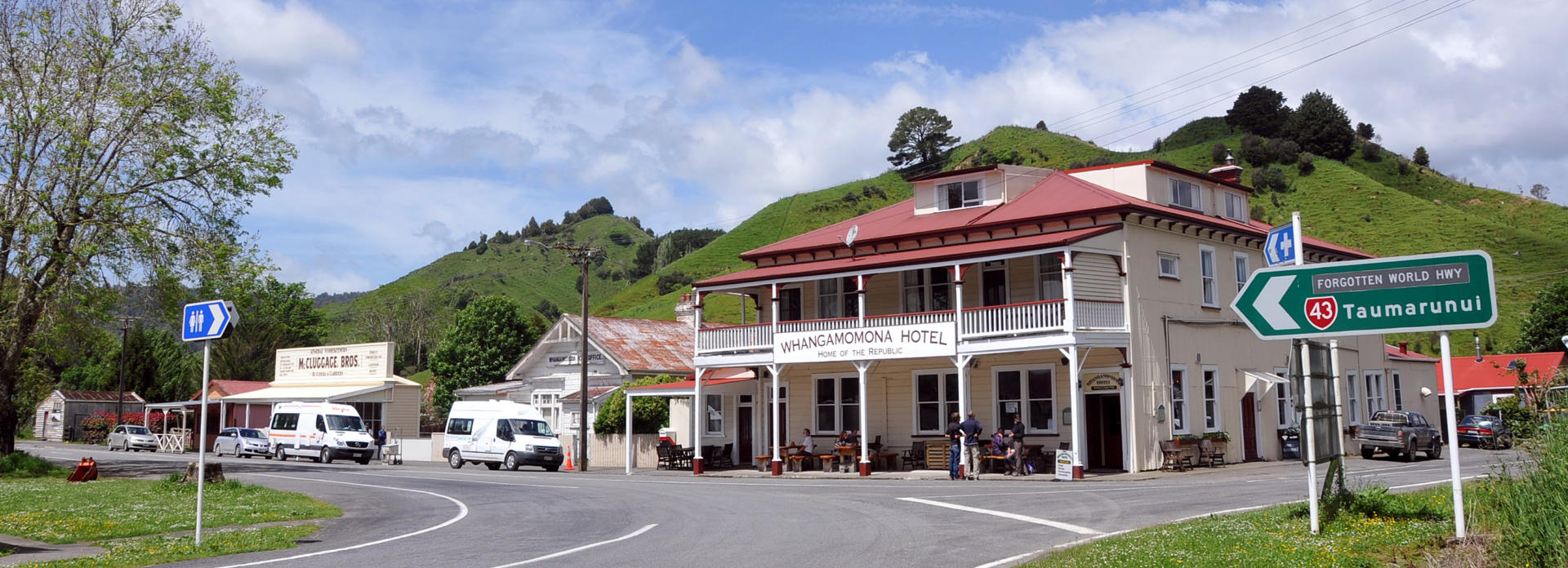
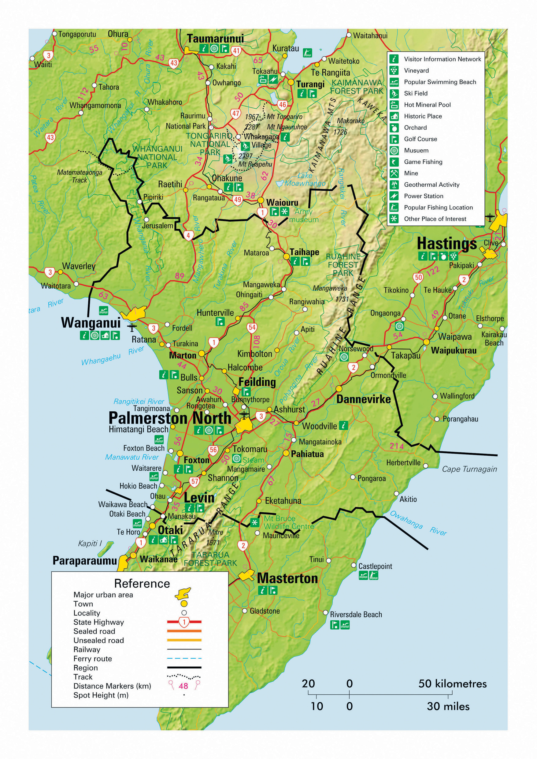
The Forgotten World Highway (SH43) route from Taumarunui in the Manawatu-Whanganui Region to Stratford in the Taranaki region offers a thoroughly enjoyable opportunity to travel through some of New Zealand’s most remote back-country for those exploring in an unhurried manner with the independence of their own set of wheels. The 143 km journey is winding, often narrow, sometimes gravel and best done as a day trip on account of the points of interest and beckoning side trips encountered along the way. A visit to the Mt Dampier Falls is rated highly and the ‘Republic’ of Whangamomona (population several people), the only settlement along the route, has a holiday park and nourishment served by friendly locals at the historic hotel.
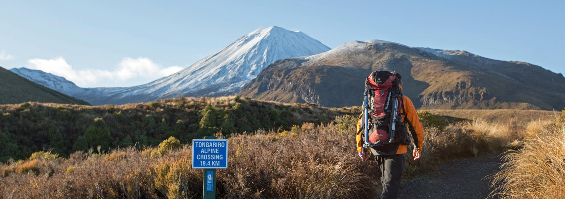
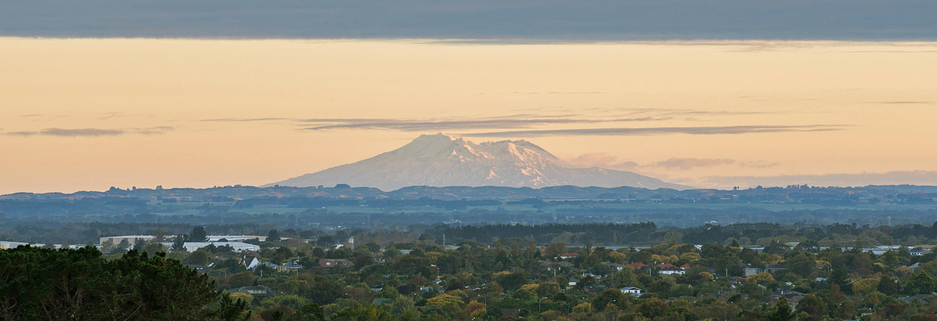
The 796 sq km Tongariro National Park is an outstanding gem and one of the most popular visitor destinations in New Zealand. Even those on limited time itineraries have the opportunity to admire the area’s grandeur from SH1 as it passes by the park’s eastern extremity, and an overnight stay within the park at the sub-alpine village of Whakapapa is highly recommended. The park was New Zealand’s first when protected by legislation in 1887 and one of the first half-dozen national parks established in the world. These days it also enjoys UNESCO World Heritage Area status. It is dominated by the three volcanic peaks of Ruapehu (2797 m), Ngauruhoe (2291 m) and Tongariro (1978 m), with the most recent significant activity being ash eruptions from Ruapehu in 1995-96. The mountains are often snow-capped year round and Ruapehu features the southern hemisphere’s northern-most glaciers. Snow occasionally falls to road levels during the winter months and the Whakapapa and Turoa ski fields on Ruapehu rate as the country’s most popular, being situated a four hour drive from the major population centres of both Auckland and Wellington. The ski season generally extends from June until October each year. A drive onward from Whakapapa Village to the base of the Whakapapa ski field affords superb views for those travelling by motorhome. The national park is also a hiker’s paradise with the 19 km Tongariro Alpine Crossing through spectacular volcanic landscapes being one of the most popular day walks in New Zealand. Other walks range from the 66 km track around Mt Ruapehu to short walks such as the Taranaki Falls loop from Whakapapa Village and others that will take fans of the Lord of the Rings trilogy of movies to scene locations. An excellent Department of Conservation information centre and holiday park are also located at Whakapapa Village, and fine dining can be enjoyed at the iconic Chateau Tongariro hotel. Other activities available in the sublime wilderness that prevails either within the national park or adjacent reserves include mountain biking the 42 Traverse or Old Coach Road Trail, quad biking and rafting and fishing on the Tongariro River. The area also hosts one of the country’s major hydro-electric power schemes with multiple tunnels of up to 20 km in length and connecting canals feeding power stations built up to 230 m underground, supplying approximately four percent of national demand.
Please note that the rapid changeability of weather in New Zealand means that all hikes require responsible preparation. It is no exaggeration to say that a cloudless morning can transform to falling snow within 30 minutes, at any time of the year. Advice should be sought from the Department of Conservation where intentions should be registered and overnight accommodation in huts can be paid for and booked if required. Sturdy footwear should be worn, warm clothing packed and food carried even for short walks in sunny weather. On any walk of several hours in duration, hikers are well advised to travel prepared to overnight and carry supplies accordingly.
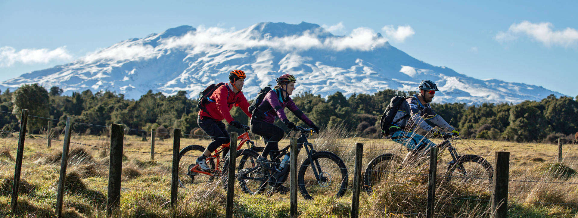
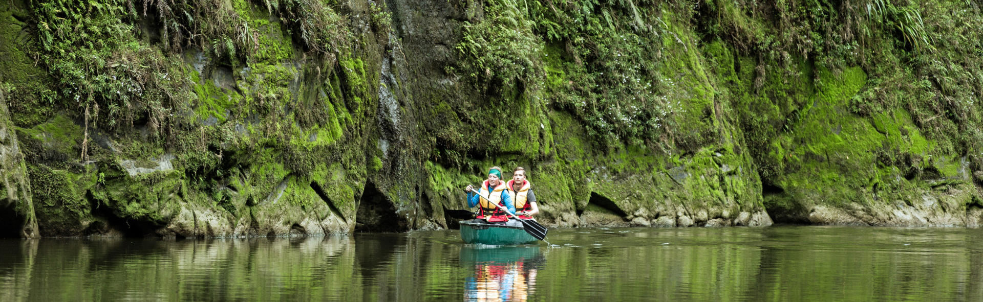
The small town of Ohakune is located just outside the southern boundary of the Tongariro National Park and serves as a convenient base from which to explore the park and surrounding attractions. A population of only around 1000 people ensures a relaxed atmosphere for much of the year, though the township does experience some invigoration during winter months when it serves as a base for skiers using the nearby Turoa field on the slopes of Mt Ruapehu. The popular Old Coach Road hiking and mountain biking trail is also a source of reliable activity for those with healthy legs during summer months. 30 km westward the settlement of Pipiriki provides a rare point of road access to the 720 sq km Whanganui National Park. There are numerous options ranging up to multi-day expeditions as ways to enjoy the navigable river from which the isolated park takes its name. Travels eastward along SH49 that passes through Ohakune soon bring one to the locality of Tangiwai, where a flood of water caused by volcanic activity releasing the contents of Mt Ruapehu’s crater lake destroyed a rail bridge on Christmas Eve of 1953. The subsequent derailment of an express train into the torrent resulted in the loss of 151 souls in one of New Zealand’s greatest catastrophes. Nearby SH49 meets SH1 at the township of Waiouru, an army training base and home to the excellent National Army Museum.
Whanganui is a provincial town of approximately 41,000 people near the mouth of the 280 km long Whanganui River. Both names were amended in 2015 to better reflect correct pronunciation after having been anglicised as Wanganui previously. The town was established among a friendly existing Maori population as one of the New Zealand Company’s earliest settlements in 1840. In 1920 Whanganui was the scene of one of the country’s most spectacular scandals when the gay mayor shot another gay man who had been harassing him. In 1976, during the early years of global computerisation, the New Zealand Police Force’s national records centre was established here and was known colloquially as the Wanganui Computer until its disestablishment 20 years later. The computer centre’s foyer was the scene of New Zealand’s only suicide bombing by a disgruntled anarchist in 1982. Around the same time the Whanganui Collegiate School counted Prince Edward among its teaching staff during his gap year, a tenure he survived without scandal. Trivia aside, Whanganui is home to one of the country’s finest art collections with the Sarjeant Gallery housing around 8000 works from the 16th to 21stcenturies. A superb view of the town centre is achieved by driving or taking the historic elevator to the top of Drurie Hill. Whanganui is situated on the SH3 route that is often overlooked by visitors on limited duration road trips. It serves as a base for those with the time available to consider visiting the remote and rugged wilderness of the Whanganui National Park.
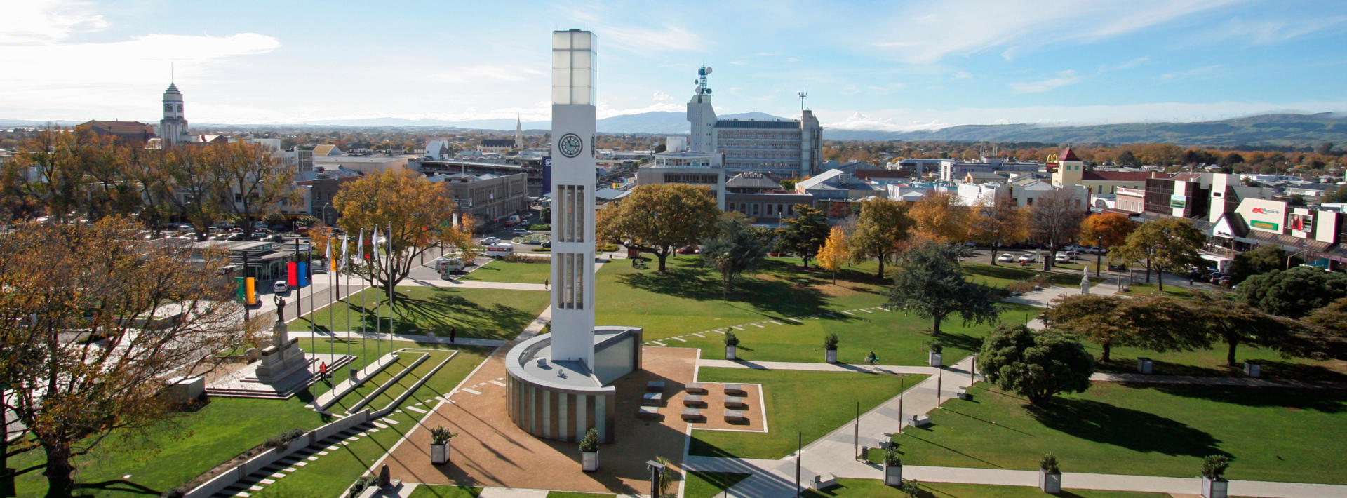
Palmerston North is an important provincial city on the Manawatu Plains that dominate the southern area of the Manawatu-Whanganui region. The city’s approximately 77,000 residents account for almost 30% of the region’s population and make it the seventh largest city in New Zealand. Like many settlements, post European origins were based around timber milling, followed by farming of the cleared land. The township added the ‘North’ to its name early to distinguish it from the Palmerston in the South Island, and is commonly referred to as simply ‘Palmy’ these days. Early settlers to the area and their descendants have the distinction of being of significantly Scandinavian origin. However, it was a London-born immigrant, businessman and dairy manufacturer who established the Glaxo brand of infant milk formula in nearby Bunnythorpe that would endure to become one of the largest pharmaceutical companies in the world in its current London based GSK incarnation. Palmerston North lies on the banks of the Manawatu River, the only river in New Zealand to flow into the sea on the opposite side of the country’s major dividing mountain range from where it originated – after flowing through the nearby Manawatu Gorge. The city is also unusual for being one of few in New Zealand not to be situated on the coast. Massey University, one of eight in New Zealand, was established in 1927 and continues to provide a strong student influence to local life. Nearby Linton Army Camp is the largest in New Zealand. Palmerston North’s central focal point is The Square, around which are situated attractions such as the Te Manawa gallery, museum and science centre, and the National Rugby Museum of a proud nation whose All Blacks rugby team hold the distinction of being the most successful national team in the history of international competition across all sports.